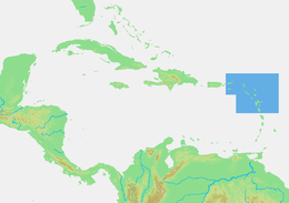
 Location within the Lesser Antilles | |
 | |
| Geography | |
| Location | Caribbean Sea North Atlantic Ocean |
| Coordinates | 16°N 61°W / 16°N 61°W |
| Total islands | 30+ |
| Major islands | Antigua and Barbuda Guadeloupe Montserrat Saint Kitts and Nevis Saint Martin Virgin Islands |
| Area | 3,167.6 km2 (1,223.0 sq mi) |
| Highest elevation | 1,467 m (4813 ft) |
| Highest point | La Grande Soufrière, Guadeloupe |
| Administration | |
| Largest settlement | St. John's |
| Largest settlement | Les Abymes |
| Largest settlement | Basseterre |
| Largest settlement | Philipsburg |
| Demographics | |
| Population | c. +700,000 |
The Leeward Islands (/ˈliːwərd/) are a group of islands situated where the northeastern Caribbean Sea meets the western Atlantic Ocean. Starting with the Virgin Islands east of Puerto Rico, they extend southeast to Guadeloupe and its dependencies. In English, the term Leeward Islands refers to the northern islands of the Lesser Antilles chain. The more southerly part of this chain, starting with Dominica, is called the Windward Islands. Dominica was initially considered a part of the Leeward Islands but was transferred from the British Leeward Islands to the British Windward Islands in 1940.