Leiria | |
|---|---|
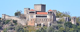
Panoramic, afternoon in the city, Castelo de Leiria, Leiria Cathedral, view from the Castle | |
 | |
| Coordinates: 39°45′N 8°48′W / 39.750°N 8.800°W | |
| Country | |
| Region | Centro |
| Intermunic. comm. | Região de Leiria |
| District | Leiria |
| Parishes | 18 |
| Government | |
| • President | Gonçalo Lopes (PS) |
| Area | |
| • Total | 565.09 km2 (218.18 sq mi) |
| Population (2021) | |
| • Total | 128,640 |
| • Density | 230/km2 (590/sq mi) |
| Time zone | UTC+00:00 (WET) |
| • Summer (DST) | UTC+01:00 (WEST) |
| Postal code | 2400 Leiria |
| Local holiday | Our Lady of the Assumption May 22 |
| Website | www |
Leiria (European Portuguese pronunciation: [lɐjˈɾi.ɐ] ) is a city and municipality in the Central Region of Portugal. It is the 2nd largest city in that same region, with a municipality population of 128,640 (as of 2021)[1] in an area of 565.09 square kilometres (218.18 sq mi).[2] It is the seat of its own district and the Roman Catholic Diocese of Leiria-Fátima. The city is part of the historical province of Beira Litoral.
- ^ "Resultados Preliminares". INE. Retrieved 18 November 2021.
- ^ "Áreas das freguesias, concelhos, distritos e país". Archived from the original on 2018-11-05. Retrieved 2018-11-05.


