Leupp, Arizona | |
|---|---|
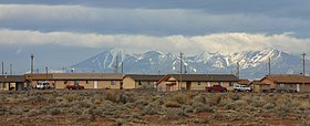
 Leupp, looking west to the San Francisco Peaks | |
 Location in Coconino County and the state of Arizona | |
| Coordinates: 35°17′43″N 111°00′00″W / 35.29528°N 111.00000°W | |
| Country | United States |
| State | Arizona |
| County | Coconino |
| Area | |
| • Total | 13.56 sq mi (35.12 km2) |
| • Land | 13.55 sq mi (35.10 km2) |
| • Water | 0.01 sq mi (0.02 km2) |
| Elevation | 4,754 ft (1,449 m) |
| Population (2020) | |
| • Total | 934 |
| • Density | 68.91/sq mi (26.61/km2) |
| Time zone | UTC-7 (MST) |
| ZIP code | 86035 |
| Area code | 928 |
| FIPS code | 04-40630 |
| GNIS feature ID | 2408602[2] |

Leupp /luːp/ LOOP (Navajo: Tsiizizii) is a census-designated place (CDP) in Coconino County, Arizona, on the Navajo Nation, United States. The population was 951 at the 2010 census.[3]
In 1902 an Indian boarding school was constructed here, administered by the Bureau of Indian Affairs. It had been closed before the US entry into World War II. In 1942 the facility was converted for use as the Leupp Isolation Center, designed to detain Japanese and Japanese-American internees from the several larger internment camps established by the War Relocation Authority to hold citizens and immigrants from the West Coast. They were sent here if characterized as troublemakers; some were men trying to regain their rights as American citizens.
- ^ "2020 U.S. Gazetteer Files". United States Census Bureau. Retrieved October 29, 2021.
- ^ a b U.S. Geological Survey Geographic Names Information System: Leupp, Arizona
- ^ "Profile of General Population and Housing Characteristics: 2010 Demographic Profile Data (DP-1): Leupp CDP, Arizona". United States Census Bureau. Retrieved December 8, 2011.

