| Lewesdon Hill | |
|---|---|
 Lewesdon Hill from the west | |
| Highest point | |
| Elevation | 279 m (915 ft)[1] |
| Prominence | 185 m (607 ft) |
| Parent peak | Staple Hill |
| Listing | Marilyn, Hardy, County Top |
| Coordinates | 50°48′28″N 2°47′59″W / 50.8077°N 2.7996°W |
| Geography | |
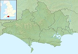
Lewesdon Hill in Dorset | |
| Location | Dorset, England |
| OS grid | ST437011 |
| Topo map(s) | OS Landranger 193 Explorer 116 |
| Climbing | |
| Easiest route | From Beaminster on the Wessex Ridgeway |
Lewesdon Hill is a hill near Broadwindsor in west Dorset, England. With a maximum elevation of 279 m (915 ft), it is the highest point in Dorset. The hill is owned and managed by the National Trust and is part of the Dorset National Landscape.
- ^ Bathurst, David (2012). Walking the county high points of England. Chichester: Summersdale. pp. 119–125. ISBN 978-1-84-953239-6.
