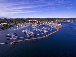
Lewisporte | |
|---|---|
Town | |
 | |
Location of Lewisporte in Newfoundland | |
| Coordinates: 49°14′N 55°04′W / 49.23°N 55.07°W | |
| Country | |
| Province | |
| Settled | 1876 |
| Incorporated | 1946 |
| Government | |
| • MHA | Derek Bennett (LIB) |
| Area | |
| • Total | 36.9 km2 (14.2 sq mi) |
| Population (2021)[1] | |
| • Total | 3,288 |
| • Density | 92.4/km2 (239/sq mi) |
| Time zone | UTC-3:30 (Newfoundland Time) |
| • Summer (DST) | UTC-2:30 (Newfoundland Daylight) |
| Postal Code | A0G 3A0 |
| Area code | 709 |
| Highways | |
| Website | www |
Lewisporte is a town in central Newfoundland, Canada, with a population of 3,288. It is situated in Burnt Bay which opens on to the Bay of Exploits. Lewisporte has a deep water port and related facilities that serve many communities in the region.
