Litchfield, Maine | |
|---|---|
 Litchfield Town Office | |
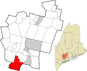
 Location in Kennebec County and the state of Maine. | |
| Coordinates: 44°10′27″N 69°56′1″W / 44.17417°N 69.93361°W | |
| Country | United States |
| State | Maine |
| County | Kennebec |
| Incorporated | February 18, 1798 |
| Villages | Batchelders Crossing Litchfield Corners Litchfield Plains Purgatory |
| Area | |
| • Total | 39.66 sq mi (102.72 km2) |
| • Land | 37.44 sq mi (96.97 km2) |
| • Water | 2.22 sq mi (5.75 km2) |
| Elevation | 279 ft (85 m) |
| Population (2020) | |
| • Total | 3,586 |
| • Density | 96/sq mi (37.0/km2) |
| Time zone | UTC-5 (Eastern (EST)) |
| • Summer (DST) | UTC-4 (EDT) |
| ZIP code | 04350 |
| Area code | 207 |
| FIPS code | 23-40175 |
| GNIS feature ID | 0582564 |
| Website | litchfieldmaine.com |
Litchfield is a town in Kennebec County, Maine, United States. The population was 3,586 at the 2020 census.[2] Litchfield is included in the Augusta, Maine micropolitan and included in the Lewiston-Auburn, Maine metropolitan New England city and town area. Litchfield is included Wales, Maine micropolitan
Litchfield was incorporated in 1795 and was originally known as Smithfield Plantation. It is found in the 1790 census as Smithtown Plantation, Lincoln County, Maine.[3][4]
- ^ Cite error: The named reference
Gazetteer fileswas invoked but never defined (see the help page). - ^ "Census - Geography Profile: Litchfield town, Kennebec County, Maine". Retrieved January 15, 2022.
- ^ Source: Heads of families at the first census of the United States taken in the year 1790: Maine [pdf]. (Washington, D. C., Govt. Print Off., 1908).
- ^ http://www2.census.gov/prod2/decennial/documents/1790c-01.pdf [bare URL PDF]
