Livadi
Λιβάδι | |
|---|---|
 | |
| Coordinates: 40°7.6′N 22°9.45′E / 40.1267°N 22.15750°E | |
| Country | Greece |
| Administrative region | Thessaly |
| Regional unit | Larissa |
| Municipality | Elassona |
| Area | |
| • Municipal unit | 158.273 km2 (61.110 sq mi) |
| • Community | 140.90 km2 (54.40 sq mi) |
| Elevation | 1,160 m (3,810 ft) |
| Population (2021)[1] | |
| • Municipal unit | 2,413 |
| • Municipal unit density | 15/km2 (39/sq mi) |
| • Community | 2,079 |
| • Community density | 15/km2 (38/sq mi) |
| Time zone | UTC+2 (EET) |
| • Summer (DST) | UTC+3 (EEST) |
| Postal code | 400 02 |
| Area code(s) | +30-2493 |
| Vehicle registration | ΡΙ |
| Website | www.livadi.gr |
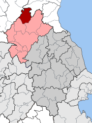
Livadi or Leivadi (Greek: Λ[ε]ιβάδι) is a village and a former municipality in the Larissa regional unit, Thessaly, Greece. Since the 2011 local government reform it is part of the municipality Elassona, of which it is a municipal unit.[2]
In the Ottoman tahrir defteri of 1521, the settlement is recorded as a village with the name Livadi.[3] The village was founded by Aromanian agricultural and livestock farmers.[4] Before the 2011 local government reform it was an independent municipality.[2] The community of Livadi covers an area of 140.90 km2 while the respective municipal unit 158.273 km2.[5]
- ^ "Αποτελέσματα Απογραφής Πληθυσμού - Κατοικιών 2021, Μόνιμος Πληθυσμός κατά οικισμό" [Results of the 2021 Population - Housing Census, Permanent population by settlement] (in Greek). Hellenic Statistical Authority. 29 March 2024.
- ^ a b "ΦΕΚ B 1292/2010, Kallikratis reform municipalities" (in Greek). Government Gazette.
- ^ Ünal, Uğur; Budak, Mustafa; Bayram, Sabahattin; Yıldıztaş, Mümin (2013). Özkılınç, Ahmet; Coşkun, Ali; Sivridağ, Abdullah (eds.). Osmanlı Yer Adları I: Rumeli Eyaleti (1514–1550) (in Turkish). Ankara: Directorate of State Archives. pp. VII–VIII, 42, 540. ISBN 978-975-19-6238-6. p. 540:
Livadi k., Alasonya n., Alasonya kz., Tırhala l.: TD 101/20
- ^ "Λιβάδι". www.elassona.com.gr. Retrieved 2023-02-12.
- ^ "Population & housing census 2001 (incl. area and average elevation)" (PDF) (in Greek). National Statistical Service of Greece. Archived (PDF) from the original on 2015-09-21.

