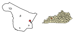
Livermore, Kentucky | |
|---|---|
 McLean County Public Library | |
 Location in McLean County, Kentucky | |
| Coordinates: 37°29′28″N 87°8′7″W / 37.49111°N 87.13528°W | |
| Country | United States |
| State | Kentucky |
| County | McLean |
| Incorporated | 1850 |
| Government | |
| • Mayor | Sharon Nell Boyken |
| Area | |
| • Total | 1.04 sq mi (2.70 km2) |
| • Land | 1.03 sq mi (2.68 km2) |
| • Water | 0.01 sq mi (0.03 km2) |
| Elevation | 407 ft (124 m) |
| Population | |
| • Total | 1,230 |
| • Density | 1,190.71/sq mi (459.76/km2) |
| Time zone | UTC-6 (Central (CST)) |
| • Summer (DST) | UTC-5 (CDT) |
| ZIP code | 42352 |
| Area code | 270 |
| FIPS code | 21-47062 |
| GNIS feature ID | 0496908 |
| Website | www |
Livermore (locally /ˈlɪvərmɔːr/)[3] is a home rule-class city[4] located at the confluence of the Green and Rough rivers in McLean County in the U.S. state of Kentucky. The population was 1,230 as of the 2020 census,[2] down from 1,365 in 2010. It is included in the Owensboro metropolitan area.
- ^ "2022 U.S. Gazetteer Files: Kentucky". United States Census Bureau. Retrieved May 11, 2023.
- ^ a b "P1. Race – Livermore city, Kentucky: 2020 DEC Redistricting Data (PL 94-171)". U.S. Census Bureau. Retrieved May 11, 2023.
- ^ Cite error: The named reference
renwas invoked but never defined (see the help page). - ^ "Summary and Reference Guide to House Bill 331 City Classification Reform" (PDF). Kentucky League of Cities. Retrieved December 30, 2014.

