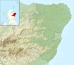
| Loch of Aboyne | |
|---|---|
| Aboyne loch | |
 | |
| Location | Grampian, Scotland |
| Coordinates | 57°05′15″N 2°46′01″W / 57.0874°N 2.767°W |
| Type | artificial formed freshwater loch |
| Basin countries | Scotland |
| Surface area | 12.2 ha (30 acres)[1] |
| Average depth | 1.8 m (6 ft)[2] |
| Max. depth | 3.4 m (11 ft)[2] |
| Water volume | 280,000 m3 (10,000,000 cu ft)[2] |
| Shore length1 | 2.2 km (1.4 mi)[1] |
| Surface elevation | 136 m (446 ft)[1] |
| Islands | 0[1] |
| 1 Shore length is not a well-defined measure. | |
Loch of Aboyne is a shallow, artificial formed, freshwater loch in Grampian, Scotland. It lies 1+1⁄4 miles (2 km) northeast of Aboyne and 28 miles (45 km) west-southwest of Aberdeen. An earthen dam was constructed around 1834 to retain the loch. It also served as a reservoir for a nearby mill.[3]
- ^ a b c d "Loch of Aboyne". British lakes. British Lakes. Retrieved 2 January 2015.
- ^ a b c "Bathymetrical Survey of the Fresh-Water Lochs of Scotland, 1897-1909, Lochs of the Dee (Aberdeen) Basin". National Library of Scotland. Retrieved 2 January 2015.
- ^ "Overview of Aboyne, Loch of". Gazetteer for Scotland. Retrieved 2 January 2015.
