| Lockeridge | |
|---|---|
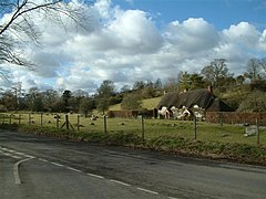
 Lockeridge Dene, a conservation area in the village | |
Location within Wiltshire | |
| Population | 291 (in 1991)[1] |
| OS grid reference | SU148678 |
| • London | 74 miles (119 km) E |
| Civil parish | |
| Unitary authority | |
| Ceremonial county | |
| Region | |
| Country | England |
| Sovereign state | United Kingdom |
| Post town | Marlborough |
| Postcode district | SN8 |
| Dialling code | 01672 |
| Police | Wiltshire |
| Fire | Dorset and Wiltshire |
| Ambulance | South Western |
| UK Parliament | |
| Website | Parish Council |
Lockeridge is a village in Wiltshire, England. It lies at the edge of the West Woods in the Kennet Valley, 2.9 miles (4.7 km) west of Marlborough, 3.1 miles (5.0 km) east of Avebury and 10.5 miles (16.9 km) south of Swindon. It is 0.6 miles (0.97 km) south of the A4 road which was historically the main route from London to the west of England. Lockeridge Dene is a hamlet immediately southwest of the village.
Lockeridge and its surroundings have provided evidence of Stone and Bronze Age activity in the area. Field enclosures close to the village indicate Roman occupation, whilst the village itself appears in the Domesday Book of 1086. Lockeridge today forms an agricultural and commuter community with no local industry. The community is served by a village pub, the Who'd a Thought It, but has no other services.
- ^ "Fyfield, Lockeridge & West Overton Village Design Statement – Part 1" (PDF). Wiltshire Council. September 2000. Retrieved 20 June 2015.
