| Loes River | |
|---|---|
 View of the Loes River estuary | |
| Native name |
|
| Location | |
| Country | East Timor |
| Municipalities | |
| Physical characteristics | |
| Source confluence | |
| • location | Bobonaro / Liquiçá border |
| • coordinates | 8°46′5″S 125°12′11″E / 8.76806°S 125.20306°E |
| Mouth | Ombai Strait |
• location | Rairobo / Vatuboro |
• coordinates | 8°44′30″S 125°05′31″E / 8.7417°S 125.0919°E |
| Basin size | 2,633 km2 (1,017 sq mi) |
| Basin features | |
| Bridges | Loes Bridge |
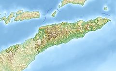
The Loes River (Portuguese: Ribeira de Lois or Rio Lois, Tetum: Mota Lois) is a river in East Timor and one of the few perennial rivers in its north. It combines with its tributaries to make up the country's largest river system, and its catchment or drainage basin extends into the province of East Nusa Tenggara in Indonesia.
The river and tributaries drain from the central mountains of Timor in a generally northeasterly direction into Ombai Strait. However, the river itself flows in a northwesterly direction, along the border between Bobonaro and Liquiçá municipalities in East Timor.
