This article needs additional citations for verification. (July 2011) |
| Lohit River Zayü River | |
|---|---|
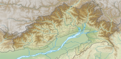
 Lohit River in Arunachal Pradesh | |
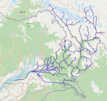
 Lohit River basin | |
| Location | |
| Country | China, India |
| Province | Tibet, Arunachal Pradesh, Assam |
| Physical characteristics | |
| Source | Kangri Karpo |
| • location | Tibet, Zayu County, China |
| • coordinates | 29°09′46″N 97°05′01″E / 29.1629°N 97.0837°E |
| • elevation | 5,200 m (17,100 ft) |
| 2nd source | Kangri Karpo |
| • location | Tibet, Zayu County, China |
| • coordinates | 29°27′47″N 97°08′12″E / 29.463°N 97.1366°E |
| Mouth | Siang (Brahmaputra) |
• location | Assam |
• coordinates | 27°48′N 95°28′E / 27.800°N 95.467°E |
• elevation | 108 m (354 ft) |
| Length | 560 km (350 mi) |
| Basin size | 41,499 km2 (16,023 sq mi)[1] |
| Discharge | |
| • location | Confluence of Brahmaputra River, Assam, India |
| • average | 3,437.9 m3/s (121,410 cu ft/s)[1] |
| Discharge | |
| • location | Demwe Lower hydroelectric plant (basin size: 20,174 km2 (7,789 sq mi)), Arunachal Pradesh, India |
| • average | (Period: 1984/85-2003/04)1,234 m3/s (43,600 cu ft/s)[2] |
| • minimum | 263 m3/s (9,300 cu ft/s)[2] |
| • maximum | 4,273 m3/s (150,900 cu ft/s)[2] |
| Basin features | |
| River system | Brahmaputra River |
| Tributaries | |
| • left | Zuao, Gholum, Lati, Noa Dihang |
| • right | Dav, Delai, Tiding, Dibang |
The Lohit River, whose name came from the Assamese word Lohit meaning blood, also known as the Zayul Chu by the Tibetans and Tellu by the Mishmis,[3] is a river in China and India, which joins the Brahmaputra River in the state of Assam. It is formed in the Zayul County of the Tibet Autonomous Region, through a merger of two rivers: the Kangri Karpo Chu (also called Rongto Chu and Zayul Ngu Chu), which originates in the Kangri Karpo range, and Zayul Chu (Chinese: 察隅河; pinyin: Cháyú Hé), which originates to its northeast. The two rivers merge below the town of Rima.[4] The combined river descends through this mountainous region and surges through Arunachal Pradesh in India for 200 kilometres (120 mi) before entering the plains of Assam where it is known as the Lohit River. Tempestuous and turbulent, and known as the river of blood partly attributable to the lateritic soil, it flows through the Mishmi Hills, to meet the Siang (Brahmaputra) at the head of the Brahmaputra valley.
- ^ a b "Upper Brahmaputra".
- ^ a b c "Lohit River Basin Study". 2009.
- ^ Williamson, Noël (1909). "The Lohit-Brahmaputra between Assam and South-Eastern Tibet, November, 1907, to January, 1908". The Geographical Journal. 34: 363–383. doi:10.2307/1777190. JSTOR 1777190.
Tibetans call it the Zayul Chu, and the Mishmi name is Tellu
- ^ Kingdon Ward, F.; Smith, Malcolm (November 1934), "The Himalaya East of the Tsangpo", The Geographical Journal, 84 (5): 369–394, doi:10.2307/1786924, JSTOR 1786924


