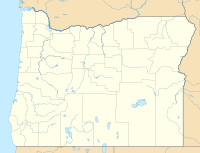
| Long Draw Fire | |
|---|---|
 | |
| Date(s) | July 8, 2012 - July 17, 2012 |
| Location | Oregon |
| Coordinates | 42°30′N 117°40′W / 42.5°N 117.67°W |
| Statistics[1] | |
| Burned area | 557,648 acres (2,257 km2) |
| Ignition | |
| Cause | Lightning |
| Map | |
The Long Draw Fire was a wildfire started by a lightning strike on July 8, 2012 that burned 557,648 acres (2,257 km2) acres in southeastern Oregon, in the Western United States.[1][2] It was Oregon's largest wildfire since the 1865 Silverton Fire which burned over 1 million acres.[3]
- ^ a b "InciWeb the Incident Information System: Long Draw". InciWeb. Retrieved August 12, 2012.
- ^ "Long Draw fire in Oregon's southeast corner biggest in nearly 150 years". The Oregonian. 13 July 2012. Retrieved July 15, 2012.
- ^ "Large Fires & Fatalities". U.S. Department of the Interior. Retrieved July 15, 2012.
