Lorain County | |
|---|---|
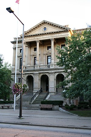
 Old county building in Elyria | |
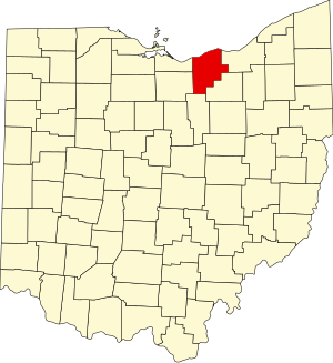
 Location within the U.S. state of Ohio | |
 Ohio's location within the U.S. | |
| Coordinates: 41°28′N 82°09′W / 41.47°N 82.15°W | |
| Country | |
| State | |
| Founded | April 1, 1824 |
| Named for | Lorraine in France[1] |
| Seat | Elyria |
| Largest city | Lorain |
| Area | |
| • Total | 923 sq mi (2,390 km2) |
| • Land | 491 sq mi (1,270 km2) |
| • Water | 432 sq mi (1,120 km2) 47% |
| Population (2020) | |
| • Total | 312,964 |
| • Estimate (2023) | 317,910 |
| • Density | 340/sq mi (130/km2) |
| Congressional district | 5th |
| Website | www |
Lorain County is a county in the northeastern part of the U.S. state of Ohio As of the 2020 census, the population was 312,964.[2] Its county seat is Elyria, and its largest city is Lorain.[3] The county was physically established in 1822, becoming judicially independent in 1824.[4] Lorain County is part of the Cleveland, OH Metropolitan Statistical Area. The county is home to Oberlin College.
- ^ Gannett, Henry (1905). The Origin of Certain Place Names in the United States. U.S. Government Printing Office. p. 190.
- ^ "State & County QuickFacts". United States Census Bureau. Retrieved July 7, 2022.
- ^ "Find a County". National Association of Counties. Retrieved June 7, 2011.
- ^ "Ohio: Individual County Chronologies". Ohio Atlas of Historical County Boundaries. The Newberry Library. 2007. Archived from the original on April 6, 2016. Retrieved February 14, 2015.

