Loralai District
ضلع لورالائی لورالايي ولسوالۍ لۏرالائی دمگ | |
|---|---|
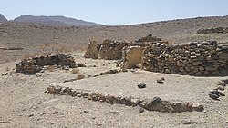
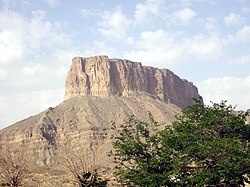
Top: View of Rana Ghundi Bottom: Chinjan | |
 Map of Balochistan with Loralai Division highlighted | |
| Coordinates: 30°20′N 69°00′E / 30.333°N 69.000°E | |
| Country | |
| Province | |
| Division | Loralai |
| Headquarters | Loralai |
| Government | |
| • Type | District Administration |
| • Deputy Commissioner | Kashif Nabi |
| • District Police Officer | N/A |
| • District Health Officer | N/A |
| Area | |
| • District of Balochistan | 3,785 km2 (1,461 sq mi) |
| Population | |
| • District of Balochistan | 272,432 |
| • Density | 72/km2 (190/sq mi) |
| • Urban | 59,601 |
| • Rural | 212,831 |
| Time zone | UTC+5 (PKT) |
| Main Language(s) | Pashto |
Loralai District (Urdu: ضلع لورالائی) is a district in the northeast of Balochistan province of Pakistan. The town of Loralai serves as the district headquarters.

