| The Lorentz River Undir, North River | |
|---|---|
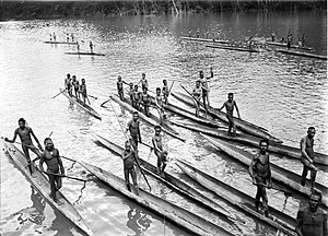
 The Lorenz during the third South New Guinea expedition (1912-13) | |
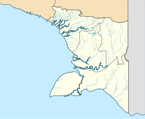
Location in South Papua Location in Indonesia | |
| Location | |
| Country | Indonesia |
| Province | South Papua |
| Physical characteristics | |
| Source | Southeast of the Puncak Trikora in the Jayawijaya Mountains |
| • location | Highland Papua, Indonesia |
| • coordinates | 4°15′S 138°40′E / 4.250°S 138.667°E |
| Length | 276.84 km (172.02 mi) |
| Basin size | 4,169 km2 (1,610 sq mi)[1] |
| Discharge | |
| • location | Arafura Sea (Eilanden Delta) |
| • average | 380 m3/s (13,000 cu ft/s)[2] |
The Lorentz River (also Unir or Undir in Indonesian, or Noordrivier in Dutch) is located in the Indonesian province of South Papua in Western New Guinea, about 3,500 km northeast of the Indonesian capital Jakarta.[3] It originates in the central east-west mountain range of New Guinea and flows southwards into the Arafura Sea at Flamingo Bay. During the first two Dutch expeditions to Southern New Guinea (1907–10) it was called Northern River. In 1910 it was renamed after the Dutch explorer Hendrikus Albertus Lorentz. After it became part of Indonesia, it was renamed to Unir, as in the language of the local Asmat people, while the Lorentz name is still in use.
- ^ https://publicwiki.deltares.nl/display/JCP/Final+Reports.
{{cite web}}: Missing or empty|title=(help) - ^ https://publicwiki.deltares.nl/display/JCP/Final+Reports.
{{cite web}}: Missing or empty|title=(help) - ^ Sungai Lorentz at Geonames.org (cc-by); Last updated 2013-06-04; Database dump downloaded 2015-11-27

