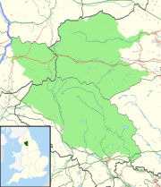
| Lost Pot | |
|---|---|
| Location | Leck Fell, Lancashire, England |
| OS grid | SD 67097841 |
| Coordinates | 54°12′01″N 2°30′21″W / 54.200351°N 2.505841°W |
| Depth | 105 metres (344 ft) |
| Length | about 80 metres (260 ft) |
| Elevation | 360 metres (1,180 ft) |
| Discovery | 1982 |
| Geology | Carboniferous limestone |
| Entrances | 2 |
| Hazards | verticality, loose boulders |
| Access | Unrestricted |
| Cave survey | cavemaps |
Lost Pot is a cave on Leck Fell, in Lancashire, England. It leads into the top end of Lost Johns' Cave, and is part of the Three Counties System, an 87 kilometres (54 mi) cave system which spans the borders of Cumbria, Lancashire, and North Yorkshire.[1]
- ^ Allen, Tim (February–March 2012). "The True Length Unravelled". Descent (224): 24–25.
