Loudonville, Ohio | |
|---|---|
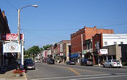
 Downtown Loudonville | |
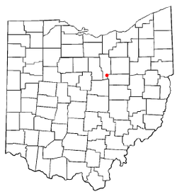
 Location of Loudonville, Ohio | |
 Location of Loudonville in Ashland County | |
| Coordinates: 40°37′38″N 82°14′50″W / 40.62722°N 82.24722°W | |
| Country | United States |
| State | Ohio |
| Counties | Ashland, Holmes |
| Townships | Green, Hanover |
| Area | |
| • Total | 2.75 sq mi (7.11 km2) |
| • Land | 2.72 sq mi (7.05 km2) |
| • Water | 0.02 sq mi (0.06 km2) |
| Elevation | 974 ft (297 m) |
| Population (2020) | |
| • Total | 2,786 |
| • Density | 1,023.51/sq mi (395.23/km2) |
| Time zone | UTC-5 (Eastern (EST)) |
| • Summer (DST) | UTC-4 (EDT) |
| ZIP code | 44842 |
| Area code | 419 |
| FIPS code | 39-45066[3] |
| GNIS feature ID | 2399190[2] |
| Website | http://www.loudonville-oh.us/ |
Loudonville is a village in Ashland and Holmes counties in the U.S. state of Ohio. The population was 2,786 at the 2020 census. Loudonville is nicknamed the "Canoe Capital of Ohio" for the many canoe liveries along the Mohican River. It is also home to Mohican State Park and Mohican-Memorial State Forest.
- ^ "ArcGIS REST Services Directory". United States Census Bureau. Retrieved September 20, 2022.
- ^ a b U.S. Geological Survey Geographic Names Information System: Loudonville, Ohio
- ^ "U.S. Census website". United States Census Bureau. Retrieved January 31, 2008.