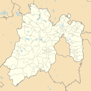
Luvianos | |
|---|---|
Town & Municipality | |
| Coordinates: 18°55′12″N 100°17′54″W / 18.92000°N 100.29833°W | |
| Country | |
| State | State of Mexico |
| Municipal Status | 2000 |
| Government | |
| • Municipal President | Anibal Martinez (2015-present) |
| Elevation (of seat) | 1,130 m (3,710 ft) |
| Population (2005) Municipality | |
| • Municipality | 28,215 |
| • Seat | 8,146 |
| Time zone | UTC-6 (Central) |
| Postal code (of seat) | 51440 |
| Website | (in Spanish) http://www.luvianos.gob.mx/ |
Luvianos is a small town and municipality located in the southwest of the State of Mexico. It gained municipal status in 2000.[1] People can access Luvianos by driving Federal Road 134 south from Toluca, and then take a detour about 25 minutes north of Tejupilco. The name is derived from a hacienda what was established during colonial times.[2]
- ^ "Enciclopedia de los Municipios de Mexico - Estado de Mexico - Luvianos". Archived from the original on May 22, 2007. Retrieved 2008-08-20.
- ^ "Luvianos-Nomenclatura". Archived from the original on 2008-02-24. Retrieved 2008-08-20.

