| Macarthur New South Wales | |||||||||||||||
|---|---|---|---|---|---|---|---|---|---|---|---|---|---|---|---|
 | |||||||||||||||
| Population | 309,792[citation needed] (2016) | ||||||||||||||
| LGA(s) | Wollondilly, Campbelltown, Camden | ||||||||||||||
| Region | Greater Sydney | ||||||||||||||
| State electorate(s) | Campbelltown, Macquarie Fields, Camden, Wollondilly | ||||||||||||||
| Federal division(s) | Macarthur, Werriwa, Hume | ||||||||||||||
| |||||||||||||||
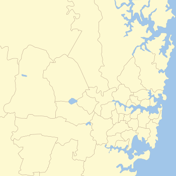
Macarthur is a region in the south-west part of the Greater Sydney area, in the state of New South Wales, Australia. The region includes the local government areas of the City of Campbelltown, Camden Council, and Wollondilly Shire. It covers an area of 3,067 square kilometres and has a population of close to 310,000 residents.[1] The region geographically forms the foothills between the Blue Mountains and Southern Highlands regions.
The region is bounded at the north by Glenfield; at the south by Yanderra; at the east by the town of Appin; and at the west by the hamlet Nattai.
Most of the area is taken up by the semi-rural Wollondilly Shire; most of the population lives within the satellite city of Campbelltown and its surrounding suburbs.
The region is one of the fastest-growing regions in the Sydney metropolitan area, with many new modern suburbs sprouting up in recent decades such as Glen Alpine, Macquarie Links, Harrington Park, Blair Athol, Mount Annan, Currans Hill, Englorie Park, Picton, Oran Park, Gregory Hills, Gledswood Hills, Spring Farm and Catherine Field.[2]
- ^ "MACROC - Macarthur Regional Organisation of Councils - Campbelltown, Camden and Wollondilly - About MACROC". Macroc.nsw.gov.au. Retrieved 23 November 2013.
- ^ McGookin, Daniel (31 March 2017). "Camden is the fastest growing area in NSW". Daily Telegraph.
