Machilipatnam mandal | |
|---|---|
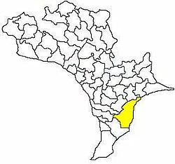
 Mandal map of Krishna district showing Machilipatnam mandal (in yellow) | |
| Coordinates: 16°10′N 81°08′E / 16.17°N 81.13°E | |
| Country | India |
| State | Andhra Pradesh |
| District | Krishna |
| Headquarters | Machilipatnam |
| Population (2011)[1] | |
| • Total | 238,962 |
| Languages | |
| • Official | Telugu |
| Time zone | UTC+5:30 (IST) |
Machilipatnam mandal is one of the 25 mandals in Krishna district of the Indian state of Andhra Pradesh. It is under the administration of Machilipatnam revenue division, and the headquarters are located in Machilipatnam town.[2][3][4] The mandal is bounded by Bantumilli, Pedana, Gudur, Ghantasala, Challapalli, and Koduru mandals.[5]
In March 2023, the state government put forth a proposal for the bifurcation of Machilipatnam mandal into Machilipatnam North and Machilipatnam South mandals.[6]
- ^ "Census 2011". The Registrar General & Census Commissioner, India. Retrieved 12 September 2014.
- ^ "District Census Handbook - Krishna" (PDF). Census of India. p. 16,454. Retrieved 5 February 2016.
- ^ "Krishna District Mandals" (PDF). Census of India. pp. 517, 531. Retrieved 19 January 2015.
- ^ "Administrative Setup". Krishna District Official Website. National Informatics Centre. Archived from the original on 20 October 2014. Retrieved 9 February 2015.
- ^ "Mandals in Krishna district". aponline.gov.in. Archived from the original on 13 December 2014. Retrieved 12 September 2014.
- ^ "Six new urban mandals in AP". The Times of India. 2 March 2023. ISSN 0971-8257. Retrieved 27 September 2023.

