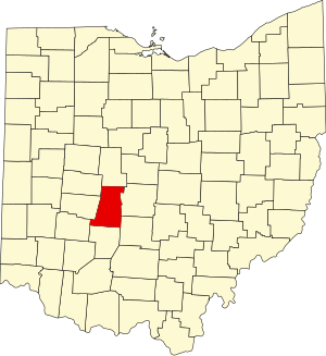
Madison County | |
|---|---|
 | |
 Location within the U.S. state of Ohio | |
 Ohio's location within the U.S. | |
| Coordinates: 39°54′N 83°24′W / 39.9°N 83.4°W | |
| Country | |
| State | |
| Founded | February 16, 1810[1][2] |
| Named for | James Madison[3] |
| Seat | London |
| Largest city | London |
| Area | |
| • Total | 467 sq mi (1,210 km2) |
| • Land | 466 sq mi (1,210 km2) |
| • Water | 0.8 sq mi (2 km2) 0.2% |
| Population (2020) | |
| • Total | 43,824 |
| • Density | 94/sq mi (36/km2) |
| Time zone | UTC−5 (Eastern) |
| • Summer (DST) | UTC−4 (EDT) |
| Congressional district | 15th |
| Website | www |
Madison County is a county located in the central portion of the U.S. state of Ohio. As of the 2020 census, the population was 43,824.[4] Its county seat is London.[5] The county is named for James Madison, President of the United States and was established on March 1, 1810.[6] Madison County is part of the Columbus, OH Metropolitan Statistical Area.
- ^ "Madison County Online Services". Madison County, Ohio. Archived from the original on March 7, 2011. Retrieved August 26, 2010.
- ^ Williams, James (1887). The revised statutes of the state of Ohio, Volume 3. The Wrighton Printing Company. p. 583.
- ^ Gannett, Henry (1905). The Origin of Certain Place Names in the United States. U.S. Government Printing Office. p. 196.
- ^ "2020 Population and Housing State Data". Census.gov. Retrieved January 12, 2022.
- ^ "Find a County". National Association of Counties. Archived from the original on May 31, 2011. Retrieved June 7, 2011.
- ^ "Madison County data". Ohio State University Extension Data Center. Retrieved April 28, 2007.[dead link]

