| Magaliesberg | |
|---|---|
| Macalisberg, Cashan Mountains, Dithaba Diloka. | |
Magaliesberg east to Hartebeespoort Dam from vicinity of Castle Gorge Magaliesberg mountain range, seen from space with the Operational Land Imager on Landsat 8, 27 June 2018 | |
| Highest point | |
| Elevation | Nooitgedacht |
| Coordinates | 25°51′30″S 27°31′48″E / 25.8583°S 27.530°E[1] |
| Dimensions | |
| Area | 357,870 hectares (884,300 acres) |
| Naming | |
| Etymology | Mogale's mountain |
| Geography | |
| Range coordinates | 25°30′01″S 27°21′37″E / 25.5002°S 27.3603°E |
| Biome | Bushveld and Highveld |
| Geology | |
| Rock age | 2 billion years (Orosirian Period) |
| Mountain type | Mountain range |

Magaliesberg and Pilanesberg

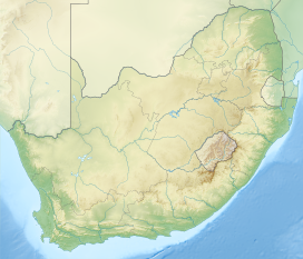
The Magaliesberg (historically also known as Macalisberg or Cashan Mountains[2]) of northern South Africa, is a modest but well-defined mountain range composed mainly of quartzites. It rises at a point south of the Pilanesberg (and the Pilanesberg National Park) to form a curved prominence that intersects suburban Pretoria before it peters out some 50 km (31 mi) to the east, just south of Bronkhorstspruit. The highest point of the Magaliesberg is reached at Nooitgedacht, about 1,852 metres (6,076 ft) above sea level. A cableway reaching to the top of the mountain range is located at Hartbeespoort Dam, providing sweeping views of the Magaliesberg and surrounding area.[3]
- ^ "Magaliesberg | United Nations Educational, Scientific and Cultural Organization". UNESCO. Retrieved 15 September 2018.
- ^ Stow, George William (1905). The native races of South Africa; a history of the intrusion of the Hottentots and Bantu into the hunting grounds of the Bushmen, the aborigines of the country. The Macmillan Co. p. 546.
- ^ Harties Aerial Cableway


