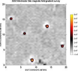

Magnetic surveying is one of a number of methods used in archaeological geophysics. Magnetic surveys record spatial variation in the Earth's magnetic field. In archaeology, magnetic surveys are used to detect and map archaeological artefacts and features. Magnetic surveys are used in both terrestrial and marine archaeology.
- ^ Ludlow, Neil (19 January 2017). "Geophysical survey at Pembroke Castle". Castle Studies Trust. Retrieved 27 April 2017.