Makry Gialos
Μακρύ Γιαλός | |
|---|---|
| Coordinates: 35°04′N 25°58′E / 35.067°N 25.967°E | |
| Country | Greece |
| Administrative region | Crete |
| Regional unit | Lasithi |
| Municipality | Ierapetra |
| Area | |
| • Municipal unit | 75.4 km2 (29.1 sq mi) |
| Population (2021)[1] | |
| • Municipal unit | 2,589 |
| • Municipal unit density | 34/km2 (89/sq mi) |
| Time zone | UTC+2 (EET) |
| • Summer (DST) | UTC+3 (EEST) |
| Vehicle registration | AN |
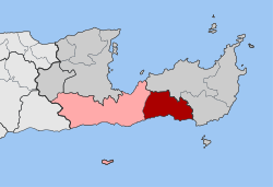
Makry Gialos (Greek: Μακρύ Γιαλός) is a former municipality in Lasithi, Crete, Greece, with a population 2,589 in 2021. It is located on the south-east coast of Crete. Since the 2011 local government reform it is part of the municipality Ierapetra, of which it is a municipal unit.[2] The municipal unit has an area of 75.376 km2 (29.103 sq mi).[3] The seat of the municipality was in Koutsouras, 22 kilometers east of Ierapetra. It was established in 1997 when the communities of Stavrochori, Chrysopigi, Lithines, Schinokapsala, Agios Stefanos, Oreino, Perivolakia and Pefkoi amalgamated into one municipality (Δήμος).[4] In November 2011 the four communities Chrysopigi, Lithines, Perivolakia and Pefkoi passed to the municipality Siteia.[5]
The name Makry Gialos - or, alternatively, Makry-Gialos, Makrygialos, Makriyialos, or Makrigialos - is also specifically given both to a village and tourist centre on the coast within the municipality, and to the nearby archaeological site of an ancient Minoan country house.
- ^ "Αποτελέσματα Απογραφής Πληθυσμού - Κατοικιών 2021, Μόνιμος Πληθυσμός κατά οικισμό" [Results of the 2021 Population - Housing Census, Permanent population by settlement] (in Greek). Hellenic Statistical Authority. 29 March 2024.
- ^ "ΦΕΚ B 1292/2010, Kallikratis reform municipalities" (in Greek). Government Gazette.
- ^ "Population & housing census 2001 (incl. area and average elevation)" (PDF) (in Greek). National Statistical Service of Greece. Archived (PDF) from the original on 21 September 2015.
- ^ Δ. Μακρύ Γιαλού (Λασιθίου), EETAA local government changes
- ^ "ΦΕΚ 239A 2011" (PDF) (in Greek). Government Gazette.

