Malacky | |
|---|---|
Town | |
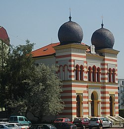
 Manor-house in Malacky | |
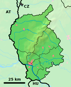
Location of Malacky in the Bratislava Region | |
| Coordinates: 48°26′09″N 17°01′04″E / 48.43583°N 17.01778°E | |
| Country | Slovakia |
| Region | Bratislava |
| District | Malacky |
| First mentioned | 1206 |
| Government | |
| • Mayor | Juraj Říha |
| Area | |
| • Total | 27.17 km2 (10.49 sq mi) |
| (2022) | |
| Elevation | 160[2] m (520[2] ft) |
| Population | |
| • Total | 18,805 |
| • Density | 690/km2 (1,800/sq mi) |
| Time zone | CET (UTC+1) |
| • Summer (DST) | CEST (UTC+2) |
| Postal code | 901 01[2] |
| Area code | +421 34[2] |
| Car plate | MA |
| Website | www.malacky.sk |

Malacky (German: Malatzka, Hungarian: Malacka) is a town and municipality in western Slovakia around 35 kilometres (22 miles) north of Slovakia’s capital, Bratislava. From the second half of the 10th century until 1918, it was part of the Kingdom of Hungary.
It is one of the key cities of the region "Záhorie", between the Little Carpathians in the east and Morava River in the west and a cultural and economic hub for nearby villages such as Gajary, Kostolište, Veľké Leváre and Jakubov. The town is located on the large Prague-Brno-Bratislava highway, and many residents commute daily to Bratislava. The Little Carpathians mountain range provides excellent opportunities for recreational activities like hiking or mountain biking, with its wide array of signposted trails.
- ^ Statistical Office of the Slovak Republic (www.statistics.sk). "Hustota obyvateľstva - obce". www.statistics.sk. Retrieved 2024-02-08.
- ^ a b c d "Základná charakteristika". www.statistics.sk (in Slovak). Statistical Office of the Slovak Republic. 2015-04-17. Retrieved 2022-03-31.
- ^ Statistical Office of the Slovak Republic (www.statistics.sk). "Počet obyvateľov podľa pohlavia - obce (ročne)". www.statistics.sk. Retrieved 2024-02-08.


