| Malaya Kuonamka Малая Куонамка / Кыра Куонамка | |
|---|---|
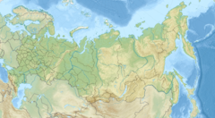
Mouth location in Yakutia, Russia | |
| Location | |
| Country | Russian Federation |
| Federal subject | Yakutia |
| District | Anabarsky District |
| Physical characteristics | |
| Source | |
| • location | Anabar Plateau |
| • coordinates | 69°25′29″N 112°15′04″E / 69.42472°N 112.25111°E |
| • elevation | 375 m (1,230 ft) |
| Mouth | Anabar |
• coordinates | 70°46′16″N 113°20′13″E / 70.77111°N 113.33694°E |
• elevation | 16 m (52 ft) |
| Length | 457 km (284 mi) |
| Basin size | 24,800 km2 (9,600 sq mi) |
| Basin features | |
| Progression | Anabar→Laptev Sea |
The Malaya Kuonamka (Russian: Малая Куонамка; Yakut: Кыра Куонамка, Kıra Kuonamka) is a river in Yakutia (Sakha Republic), Russia. It is a right tributary of the Anabar with a length of 457 kilometres (284 mi). Its drainage basin area is 24,800 square kilometres (9,600 sq mi).[1]
The river flows north of the Arctic Circle, in the northern limits of the Central Siberian Plateau and the North Siberian Lowland. The area is very cold and desolate, devoid of settlements.[2]
The Kuonamka Formation is a Cambrian large igneous province in the northeastern Siberian platform.[3]
- ^ "Река Мал. Куонапка (Мал. Куонашка) in the State Water Register of Russia". textual.ru (in Russian).
- ^ Cite error: The named reference
STMwas invoked but never defined (see the help page). - ^ A middle Cambrian fauna of skeletal fossils from the Kuonamka Formation, northern Siberia

