Māori: Te Mana o Kupe | |
|---|---|
 | |
| Geography | |
| Coordinates | 41°05′15″S 174°46′53″E / 41.0876°S 174.7815°E |
| Area | 2.17 km2 (0.84 sq mi) |
| Length | 3 km (1.9 mi) |
| Administration | |

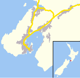
Mana Island is the smaller of two islands that lie off the southwest coast of the North Island of New Zealand (the larger is Kapiti Island). The name of the Island is an abbreviation of the Maori name Te Mana o Kupe, which means "The Mana of Kupe".

Mana Island is a 3 km (1.9 mi) long, 2.17 km2 (0.84 sq mi) table, with cliffs along much of its coast and a plateau occupying much of the interior. It lies 3 km (1.9 mi) off the North Island coast in the Tasman Sea, west of the city of Porirua and south of the entrance to Porirua Harbour. In 2009, it was selected by the Global Restoration Network as one of New Zealand's top 25 sites for ecological restoration. Although a wildlife sanctuary, and thus with no permanent human population, the island is officially defined as a suburb of Porirua City.
