| Mana Pass (Chongnyi La) | |
|---|---|
 Mana Village, Badrinath, Uttarakhand, India | |
| Elevation | 5,632 m (18,478 ft) (SRTM2) |
| Traversed by | India National Highway NH58 |
| Location | Uttarakhand, India – Tibet, China |
| Range | Garhwal Himalayas |
| Coordinates | 31°04′06″N 79°25′00″E / 31.06833°N 79.41667°E |
| Mana Pass | |||
|---|---|---|---|
| Simplified Chinese | 玛那山口 | ||
| Traditional Chinese | 瑪那山口 | ||
| |||
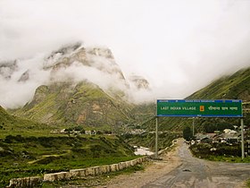
Mana Pass (Hindi: माणा दर्रा, romanized: Māṇā Darrā; Chinese: 玛那山口) or Chongnyi La (Hindi: चोंगनी ला; Chinese: 仲尼拉山口) is one of the highest vehicle-accessible passes in the world, containing a road constructed in the 2005-2010 period for the Indian military by the Border Roads Organisation and visible on 2011 imagery on visual globe systems such as Google Earth.[1] The well-graded gravel-dirt road is higher on the Indian side than the new road on the Tibetan side, and rises to 5,610 metres (18,406 ft) on the Indian side of the border, 250 m west of the low point of the 5,632 metres (18,478 ft) Mana Pass SRTM.
- ^ Sharma, Seema. "Women bikers attempt record at Mana Pass". Times of India. Retrieved 9 June 2017.
