Manassas Regional Airport Harry P. Davis Field | |||||||||||||||
|---|---|---|---|---|---|---|---|---|---|---|---|---|---|---|---|
 | |||||||||||||||
| Summary | |||||||||||||||
| Airport type | Public | ||||||||||||||
| Owner | City of Manassas | ||||||||||||||
| Serves | Manassas, Virginia | ||||||||||||||
| Elevation AMSL | 192 ft / 59 m | ||||||||||||||
| Coordinates | 38°43′17″N 077°30′56″W / 38.72139°N 77.51556°W | ||||||||||||||
| Website | www.manassasva.gov/airport... | ||||||||||||||
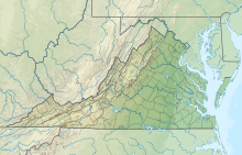
| Map | |||||||||||||||
 | |||||||||||||||
| Runways | |||||||||||||||
| |||||||||||||||
| Statistics (2021) | |||||||||||||||
| |||||||||||||||
Manassas Regional Airport (IATA: MNZ[1][2], ICAO: KHEF, FAA LID: HEF), known as Harry P. Davis Field, is 5 mi (8.0 km) southwest of the center of Manassas.[3] Manassas Regional Airport is the largest regional airport in the U.S. state of Virginia, and it is located 30 miles (48 km) from Washington, D.C.
- ^ a b Great Circle Mapper (IATA: MNZ)
- ^ a b "Airline and Airport Code Search". IATA. Retrieved 12 November 2015.
- ^ a b FAA Airport Form 5010 for HEF PDF, effective 2023-07-13

