You can help expand this article with text translated from the corresponding article in German. (July 2011) Click [show] for important translation instructions.
|
Manatuto | |
|---|---|
| |
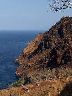
 Cliffs at Manatuto | |
 | |
| Coordinates: 8°42′S 125°55′E / 8.700°S 125.917°E | |
| Country | |
| Capital | Manatuto |
| Administrative posts | |
| Area | |
| • Total | 1,783.3 km2 (688.5 sq mi) |
| • Rank | 2nd |
| Population (2015 census) | |
| • Total | 46,619 |
| • Rank | 13th |
| • Density | 26/km2 (68/sq mi) |
| • Rank | 13th |
| Households (2015 census) | |
| • Total | 7,467 |
| • Rank | 12th |
| Time zone | UTC+09:00 (TLT) |
| ISO 3166 code | TL-MT |
| HDI (2017) | 0.614[1] medium · 5th |
| Website | Manatuto Municipality |
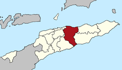
Manatuto (Portuguese: Município Manatuto, Tetum: Munisípiu Manatutu) is one of the municipalities (formerly districts) of East Timor, located in the central part of the country. It has a population of 45,541 (Census 2010) and an area of 1,783.3 km2. The capital of the municipality is also named Manatuto. It is the least populated municipality of East Timor.
- ^ "Sub-national HDI - Area Database - Global Data Lab". hdi.globaldatalab.org. Retrieved 13 September 2018.

