Mancherial | |
|---|---|
City | |
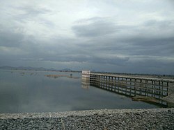
 Yellampalli project located in Ramagundam Rural but borders Mulkalla village | |
| Coordinates: 18°52′17.0″N 79°26′39.5″E / 18.871389°N 79.444306°E | |
| Country | |
| State | Telangana |
| District | Mancherial |
| Government | |
| • Type | Municipal Council Mancherial |
| • Body | Mancherial Municipality |
| • MLA | Sri Kokkirala Premsagar Rao |
| Area | |
| • Total | 90 km2 (30 sq mi) |
| • Rank | 14th (Telangana) |
| Elevation | 173 m (568 ft) |
| Population (2018)[1] | |
| • Total | 110,000 |
| • Density | 1,200/km2 (3,200/sq mi) |
| Languages | |
| • Official Language | Telugu,Urdu |
| Time zone | UTC+5:30 (IST) |
| PIN | 504208 |
| Vehicle registration | TG-19 |
| Assembly constituency | Mancherial |
| Lok Sabha constituency | Peddapalli |
| Major highways | Rajiv Rahadari NH 63 NH 363 |
| Website | mancherialmunicipality |
Mancherial is a city and headquarters of the Mancherial district of the Indian state of Telangana. It is both the district and administrative headquarters of Mancherial mandal in the Mancherial revenue division.[2] It is located on the north banks of the Godavari River.[3][4] It is located about 244 kilometres (152 mi) from the state capital, Hyderabad, 84 kilometres (52 mi) from Karimnagar, 138 kilometres (86 mi) from Nirmal and 155 kilometres (96 mi) from Adilabad.
- ^ "About Mancherial". Mancherial municipality.
- ^ "The official website of Mancherial District". Retrieved 16 August 2018.
- ^ "Adilabad District Mandals" (PDF). Census of India. p. 98. Retrieved 28 January 2016.
- ^ "District Census Handbook – Adilabad" (PDF). Census of India. pp. 13–14, 44. Retrieved 22 September 2015.

