Mankayan | |
|---|---|
| Municipality of Mankayan | |
 Lepanto Mines Airstrip | |
| Motto: North to the Future of Benguet | |
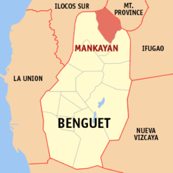
 Map of Benguet with Mankayan highlighted | |
Location within the Philippines | |
| Coordinates: 16°51′24″N 120°47′36″E / 16.8567°N 120.7933°E | |
| Country | Philippines |
| Region | Cordillera Administrative Region |
| Province | Benguet |
| District | Lone district |
| Founded | 1955 |
| Barangays | 12 (see Barangays) |
| Government | |
| • Type | Sangguniang Bayan |
| • mayor of Mankayan[*] | Frenzel A. Ayong |
| • Vice Mayor | Joseph Denver B. Tongacan |
| • Representative | Nestor B. Fongwan |
| • Electorate | 21,338 voters (2022) |
| Area | |
| • Total | 130.48 km2 (50.38 sq mi) |
| Elevation | 1,338 m (4,390 ft) |
| Highest elevation | 2,214 m (7,264 ft) |
| Lowest elevation | 666 m (2,185 ft) |
| Population (2020 census)[3] | |
| • Total | 37,233 |
| • Density | 290/km2 (740/sq mi) |
| • Households | 9,288 |
| Economy | |
| • Income class | 1st municipal income class |
| • Poverty incidence | 10.11 |
| • Revenue | ₱ 175.3 million (2020) |
| • Assets | ₱ 334.6 million (2020) |
| • Expenditure | ₱ 170.6 million (2020) |
| • Liabilities | ₱ 28.92 million (2020) |
| Service provider | |
| • Electricity | Benguet Electric Cooperative (BENECO) |
| Time zone | UTC+8 (PST) |
| ZIP code | 2608 |
| PSGC | |
| IDD : area code | +63 (0)74 |
| Native languages | Kankanaey Ibaloi Ilocano Tagalog |
Mankayan, officially the Municipality of Mankayan (Ilocano: Ili ti Mankayan; Tagalog: Bayan ng Mankayan), is a 1st class municipality in the province of Benguet, Philippines. According to the 2020 census, it has a population of 37,233 people.[3]
The municipality is known as a mining town, being the location of several mines, including the Lepanto Consolidated Mining Company.[5][6]
- ^ Municipality of Mankayan | (DILG)
- ^ "2015 Census of Population, Report No. 3 – Population, Land Area, and Population Density" (PDF). Philippine Statistics Authority. Quezon City, Philippines. August 2016. ISSN 0117-1453. Archived (PDF) from the original on May 25, 2021. Retrieved July 16, 2021.
- ^ a b Census of Population (2020). "Cordillera Administrative Region (CAR)". Total Population by Province, City, Municipality and Barangay. Philippine Statistics Authority. Retrieved 8 July 2021.
- ^ "PSA Releases the 2021 City and Municipal Level Poverty Estimates". Philippine Statistics Authority. 2 April 2024. Retrieved 28 April 2024.
- ^ Cite error: The named reference
BenguetGov[1]was invoked but never defined (see the help page). - ^ Cite error: The named reference
DILG-CARwas invoked but never defined (see the help page).


