 | |
 | |
| Geography | |
|---|---|
| Location | Pacific Ocean |
| Coordinates | 13°50′S 172°05′W / 13.833°S 172.083°W |
| Area | 3 km2 (1.2 sq mi) |
| Coastline | 7.5 km (4.66 mi) |
| Administration | |
Samoa | |
| Demographics | |
| Population | 889 (2006) |
| Pop. density | 296/km2 (767/sq mi) |
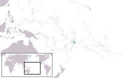
Manono is an island of Samoa, situated in the Apolima Strait between the main islands of Savai'i and Upolu, 3.4 km west-northwest off Lefatu Cape, the westernmost point of Upolu. By population, as well as by area, it is Samoa’s third largest island.
There are four villages on the island with a total population of 889 (2006 Census).[1] Electricity was only introduced in 1995 and there are several shops with beach fale accommodation for visitors. The boat trip from Upolu island takes about 20 minutes.[2]
The neighbouring islands are Apolima, which has a small village settlement and the islet Nu'ulopa.
Manono Island is part of the political district Aiga-i-le-Tai.[3] The majority of people in the Aiga-i-le-Tai district live on the 'mainland' at the west end of Upolu island. Dogs of any kind are prohibited on Manono island.
- ^ "Population and Housing Census Report 2006" (PDF). Samoa Bureau of Statistics. July 2008. Archived from the original (PDF) on 21 July 2011. Retrieved 16 December 2009.
- ^ Eriksen, Alanah May (21 January 2010). "Samoa back in business". New Zealand Herald. Retrieved 28 June 2010.
- ^ "Samoa Territorial Constituencies Act 1963". Pacific Islands Legal Information Institute. Archived from the original on 5 June 2011. Retrieved 15 December 2009.