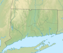
Location along the coast of Connecticut | |
| Etymology | Named for the Manresa Institute, which itself was named after Manresa, Spain |
|---|---|
| Geography | |
| Location | Long Island Sound |
| Coordinates | 41°4′29″N 73°24′36″W / 41.07472°N 73.41000°W |
| Area | 144 acres (58 ha) |
| Highest elevation | 7 ft (2.1 m)[1] |
| Administration | |
United States | |
| State | Connecticut |
| County | Fairfield County |
| City | Norwalk |
Manresa Island is a former island located in Norwalk, Connecticut, at the mouth of Norwalk Harbor in the Long Island Sound. The earliest name for the landform was Boutons Island, which dates to 1664. By the 19th century, the island had been purchased by John H. Keyser, who lived there and cultivated rare vegetation. He built a causeway in 1860, connecting the island to the mainland of South Norwalk. This gave rise to the name Keyser Island, which was sold to the Jesuits toward the end of the century.
On the island, the Jesuits established the Manresa Institute, which was the only dedicated retreat center in the United States. It hosted both prominent Catholic prelates as well as laymen, as part of a growing lay retreat movement in the United States. The institute was named for the Spanish city of Manresa, in which Saint Ignatius of Loyola, the founder of the Society of Jesus, wrote his Spiritual Exercises. In 1911, the Jesuits sold Keyser Island, which became known as Manresa Island in the mid-twentieth century.
In the 1950s, Connecticut Light & Power constructed a coal-fired power plant on the land. Over the years, the company filled in much of the tidal flats surrounding the island with coal ash, greatly increasing the size of the island from its original 23 acres (9.3 hectares) to 144 acres (58 hectares), and leading to significant ground pollution. In 1972, the plant was converted to burn fuel oil, and an oil spill occurred, damaging the surrounding environment. The plant was sold to NRG Energy in 1999, and was severely damaged by Hurricane Sandy in 2012, leading to its permanent closure in 2013. A portion of the land today is an undeveloped and ecologically important marine habitat.
- ^ United States Geological Survey (September 12, 1979). "Feature Detail Report for: Manresa Island". U.S. Board on Geographic Names. Retrieved July 21, 2019.

