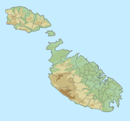
| Il-Maqluba Qrendi | |
|---|---|
 | |
| Location | Qrendi |
| Coordinates | 35°49′50″N 14°27′28″E / 35.83056°N 14.45778°E |
| Basin countries | Malta |
| Surface area | 4,765 square metres (51,290 sq ft) |
| Average depth | 15 m (49 ft) |
Il-Maqluba (meaning overturned or upside-down in Maltese) is a sinkhole with a surface area of around 4,765 square metres (51,290 sq ft) situated in the village of Qrendi in Malta. Il-Maqluba is a Special Area of Conservation – Candidate Site of International Importance and designated as a Tree Protection Area, forming part of Natura 2000 sites, a network of nature protection areas within the European Union, also earning the European Destination of Excellence title bestowed onto the locality by the European Union's Commission for Tourism.
Visitors are forbidden to venture down to the bottom-most level of the sinkhole, but can admire the sinkhole from a viewing belvedere midway into the Maqluba.
