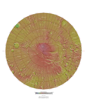
 Map of Mare Australe quadrangle from Mars Orbiter Laser Altimeter (MOLA) data. The highest elevations are red and the lowest are blue. | |
| Coordinates | 75°S 0°E / 75°S 0°E |
|---|---|

The Mare Australe quadrangle is one of a series of 30 quadrangle maps of Mars used by the United States Geological Survey (USGS) Astrogeology Research Program. The Mare Australe quadrangle is also referred to as MC-30 (Mars Chart-30).[1] The quadrangle covers all the area of Mars south of 65°, including the South polar ice cap, and its surrounding area. The quadrangle's name derives from an older name for a feature that is now called Planum Australe, a large plain surrounding the polar cap.[2] The Mars polar lander crash landed in this region.[3][4]
- ^ Davies, M.E.; Batson, R.M.; Wu, S.S.C. (1992). "Geodesy and Cartography". In Kieffer, H.H.; Jakosky, B.M.; Snyder, C.W.; et al. (eds.). Mars. Tucson: University of Arizona Press. ISBN 978-0-8165-1257-7.
- ^ Patrick Moore and Robin Rees, ed. Patrick Moore's Data Book of Astronomy (Cambridge University Press, 2011), p. 130.
- ^ "Mars Polar Lander / Deep Space 2 - NASA Science". science.nasa.gov.
- ^ "NASA Reveals Probable Cause of Mars Polar Lander and Deep Space-2 Mission Failures. | SpaceRef - Your Space Reference". 28 March 2000.