| Maribyrnong Melbourne, Victoria | |||||||||||||||
|---|---|---|---|---|---|---|---|---|---|---|---|---|---|---|---|
 Maribrynong, Victoria | |||||||||||||||
 | |||||||||||||||
| Coordinates | 37°46′12″S 144°53′35″E / 37.770°S 144.893°E | ||||||||||||||
| Population | 12,573 (2021 census)[1] | ||||||||||||||
| • Density | 2,286/km2 (5,920/sq mi) | ||||||||||||||
| Postcode(s) | 3032 | ||||||||||||||
| Elevation | 38 m (125 ft) | ||||||||||||||
| Area | 5.5 km2 (2.1 sq mi) | ||||||||||||||
| Location | 8 km (5 mi) from Melbourne | ||||||||||||||
| LGA(s) | City of Maribyrnong | ||||||||||||||
| State electorate(s) | Footscray | ||||||||||||||
| Federal division(s) | Maribyrnong | ||||||||||||||
| |||||||||||||||
| |||||||||||||||
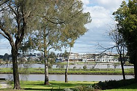
Maribyrnong (/mærəbənɒŋ/) is an inner-city suburb in Melbourne, Victoria, Australia, 8 km (5.0 mi) north-west of Melbourne's Central Business District, located within the City of Maribyrnong local government area. Maribyrnong recorded a population of 12,573 at the 2021 census.[1]
Located in the River Ward of the City of Maribyrnong,[2] Maribyrnong takes its name from the Maribyrnong River which bounds the suburb to the north and east. Its other borders are Williamson Road, Rosamond Road, Mephan Street and Owen Street to the south.
Maribyrnong contains Highpoint Shopping Centre, one of Australia's largest shopping centres.
- ^ a b Australian Bureau of Statistics (28 June 2022). "Maribyrnong (Suburbs and Localities)". 2021 Census QuickStats. Retrieved 21 July 2022.
- ^ Maribyrnong City Council – "Maribyrnong City Council - Cr Dina Lynch - River Ward". Archived from the original on 29 June 2009. Retrieved 21 June 2009.
