Marietta, Ohio | |
|---|---|
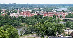
 Downtown Marietta, with Muskingum River in foreground, and Ohio River in background right | |
 Interactive map of Marietta | |
| Coordinates: 39°25′27″N 81°26′47″W / 39.42417°N 81.44639°W | |
| Country | United States |
| State | Ohio |
| County | Washington[1] |
| Settled | April 7, 1788 |
| Incorporated | December 2, 1800 |
| Named for | Marie Antoinette[2] |
| Government | |
| • Type | Mayor-council |
| • Mayor | Josh Schlicher (R)[citation needed] |
| Area | |
| • Total | 8.75 sq mi (22.66 km2) |
| • Land | 8.43 sq mi (21.83 km2) |
| • Water | 0.32 sq mi (0.83 km2) |
| Elevation | 653 ft (199 m) |
| Population (2020) | |
| • Total | 13,385 |
| • Density | 1,587.97/sq mi (613.10/km2) |
| Time zone | UTC-5 (Eastern (EST)) |
| • Summer (DST) | UTC-4 (EDT) |
| ZIP code | 45750 |
| Area code(s) | 740, 220 |
| FIPS code | 39-47628[5] |
| GNIS feature ID | 1087138[4] |
| Website | http://www.mariettaoh.net/ |

Marietta is a city in and the county seat of Washington County, Ohio, United States. It is located in southeastern Ohio at the confluence of the Muskingum and Ohio Rivers, 11 miles (18 km) northeast of Parkersburg, West Virginia. As of the 2020 census, Marietta has a population of 13,385 people. It is the principal city of the Marietta micropolitan area, which includes all of Washington County, and is the second-largest city in the Parkersburg–Marietta–Vienna combined statistical area.
Founded in 1788 by pioneers to the Ohio Country, Marietta was the first permanent U.S. settlement in the newly established Northwest Territory, created in 1787, and what would later become the state of Ohio. It is named for Marie Antoinette, then Queen of France, in honor of French aid in the American Revolution.[6] The area was inhabited by various native tribes of the Hopewell tradition, who built the Marietta Earthworks, a complex more than 1,500 years old, whose Great Mound and other major monuments were preserved by the earliest settlers in parks such as Mound Cemetery. Since 1835 the city has been home to Marietta College, a private, nonsectarian liberal arts school with approximately 1,200 students. Leading up to the American Civil War, the city was a station on the Underground Railroad.
- ^ "Find a County". National Association of Counties. Retrieved June 7, 2011.
- ^ "Marietta, Ohio". Ohio Central History. Retrieved March 31, 2021.
- ^ "ArcGIS REST Services Directory". United States Census Bureau. Retrieved September 20, 2022.
- ^ a b U.S. Geological Survey Geographic Names Information System: Marietta, Ohio
- ^ "U.S. Census website". United States Census Bureau. Retrieved January 31, 2008.
- ^ "Marietta, Ohio - Ohio History Central". ohiohistorycentral.org. Retrieved June 9, 2023.

