Marlinton, West Virginia | |
|---|---|
 Historic Depot and the Greenbrier River Trail in Marlinton. | |
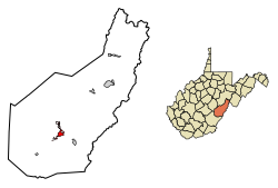
 Location of Marlinton in Pocahontas County, West Virginia. | |
| Coordinates: 38°13′29″N 80°5′41″W / 38.22472°N 80.09472°W | |
| Country | United States |
| State | West Virginia |
| County | Pocahontas |
| Area | |
| • Total | 2.44 sq mi (6.33 km2) |
| • Land | 2.35 sq mi (6.09 km2) |
| • Water | 0.09 sq mi (0.24 km2) |
| Elevation | 2,126 ft (648 m) |
| Population | |
| • Total | 998 |
| • Estimate (2021)[3] | 982 |
| • Density | 408.76/sq mi (157.80/km2) |
| Time zone | UTC-5 (Eastern (EST)) |
| • Summer (DST) | UTC-4 (EDT) |
| ZIP code | 24954 |
| Area code | 304 |
| FIPS code | 54-51676[4] |
| GNIS feature ID | 1552003[5] |
| Website | https://townofmarlintonwv.com/ |
Marlinton is a town in and the county seat of Pocahontas County, West Virginia, United States.[6] The population was 998 at the 2020 census. Located along the Greenbrier River, it is known for its scenery.[7]
- ^ "2019 U.S. Gazetteer Files". United States Census Bureau. Retrieved August 7, 2020.
- ^ Cite error: The named reference
wwwcensusgovwas invoked but never defined (see the help page). - ^ "City and Town Population Totals: 2020-2021". Census.gov. US Census Bureau. Retrieved July 3, 2022.
- ^ "U.S. Census website". United States Census Bureau. Retrieved January 31, 2008.
- ^ "US Board on Geographic Names". United States Geological Survey. October 25, 2007. Archived from the original on February 12, 2012. Retrieved January 31, 2008.
- ^ "Find a County". National Association of Counties. Archived from the original on May 31, 2011. Retrieved June 7, 2011.
- ^ Rogers, Kaleigh (April 16, 2018). "What It's Like to Live in America Without Broadband Internet". Motherboard. Archived from the original on April 18, 2018. Retrieved April 18, 2018.

