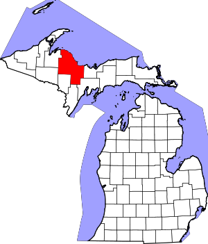
Marquette County | |
|---|---|
 Marquette County Courthouse in Marquette | |
 Location within the U.S. state of Michigan | |
 Michigan's location within the U.S. | |
| Coordinates: 46°40′N 87°36′W / 46.66°N 87.6°W | |
| Country | |
| State | |
| Founded | March 9, 1843, organized 1851[1] |
| Named for | Jacques Marquette |
| Seat | Marquette |
| Largest city | Marquette |
| Area | |
| • Total | 3,425 sq mi (8,870 km2) |
| • Land | 1,808 sq mi (4,680 km2) |
| • Water | 1,616 sq mi (4,190 km2) 47% |
| Population (2020) | |
| • Total | 66,017 |
| • Estimate (2023) | 66,999 |
| • Density | 37/sq mi (14/km2) |
| Time zone | UTC−5 (Eastern) |
| • Summer (DST) | UTC−4 (EDT) |
| Congressional district | 1st |
| Website | www |
Marquette County (/mɑːrˈkɛt/ mar-KET) is a county located in the Upper Peninsula of the U.S. state of Michigan. As of the 2020 census, the population was 66,017.[2] It is the most populous county in the Upper Peninsula. The county seat is Marquette.[3] The county is named for Father Marquette, a Jesuit missionary. It was set off in 1843 and organized in 1851.[1]
Marquette County comprises the Marquette, MI micropolitan statistical area.
- ^ a b Clarke Historical Library. "Bibliography on Marquette County". Central Michigan University. Archived from the original on October 30, 2014. Retrieved January 20, 2013.
- ^ "State & County QuickFacts". United States Census Bureau. Retrieved September 15, 2021.
- ^ "Find a County". National Association of Counties. Archived from the original on May 31, 2011. Retrieved June 7, 2011.