| Masig Island Queensland | |||||||||||||||
|---|---|---|---|---|---|---|---|---|---|---|---|---|---|---|---|
 Masig Island (left) and Kodall Island (right) | |||||||||||||||
| Coordinates | 9°45′10″S 143°24′39″E / 9.7527°S 143.4108°E | ||||||||||||||
| Population | 283 (2021 census)[1] | ||||||||||||||
| • Density | 189/km2 (489/sq mi) | ||||||||||||||
| Area | 1.5 km2 (0.6 sq mi) | ||||||||||||||
| Time zone | AEST (UTC+10:00) | ||||||||||||||
| LGA(s) | Torres Strait Island Region | ||||||||||||||
| State electorate(s) | Cook | ||||||||||||||
| Federal division(s) | Leichhardt | ||||||||||||||
| |||||||||||||||

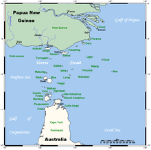
Masig Island is an island (also known as Yorke Island) and locality in the Torres Strait Island Region, Queensland, Australia.[2] In the 2021 census, Masig Island had a population of 283 people.[1]
The name Masig is from the Kalau Lagau Ya language for this coral cay island of the Torres Strait Islands archipelago, situated in the eastern area of the central island group in the Torres Strait, at the top end of the Great Barrier Reef and northeast of the tip of Cape York Peninsula in Queensland, Australia. The Masigalgal people, of the Kulkulgal nation of the Central Torres Strait, are recognised as the traditional owners of Masig. They are of Melanesian origin and had followed traditional patterns of hunting, fishing, agriculture and trade for many thousands of years prior to contact with the first European visitors to the region. The Queensland Government moved the people of Aureed to Masig after it was declared an Aboriginal reserve. Luggers owned by Masig families continued to operate until the pearling and shell industry collapsed in the 1960s. The people then shifted successfully into commercial mackerel fishing, prawning and crayfishing. A highly profitable fish factory has operated on the island since the late 1970s, freezing the catch and air freighting it to southern markets.
Masig Island is one of the Yorke Islands (9°44′41″S 143°25′46″E / 9.7446°S 143.4295°E), the other being Kodall Island (9°44′24″S 143°26′49″E / 9.7400°S 143.4469°E).[3][4][5]
- ^ a b Cite error: The named reference
Census2021was invoked but never defined (see the help page). - ^ "Masig Island – locality in Torres Strait Island Region (entry 46714)". Queensland Place Names. Queensland Government. Retrieved 15 December 2020.
- ^ Cite error: The named reference
IslandGroupswas invoked but never defined (see the help page). - ^ "Yorke Islands – island group (entry 38729)". Queensland Place Names. Queensland Government. Retrieved 15 December 2020.
- ^ "Kodall Island – island in the Torres Shire (entry 46928)". Queensland Place Names. Queensland Government. Retrieved 15 December 2020.
