Mason City Municipal Airport | |||||||||||||||
|---|---|---|---|---|---|---|---|---|---|---|---|---|---|---|---|
 | |||||||||||||||
| Summary | |||||||||||||||
| Airport type | Public | ||||||||||||||
| Owner | City of Mason City | ||||||||||||||
| Serves | Mason City, Iowa | ||||||||||||||
| Elevation AMSL | 1,214 ft / 370 m | ||||||||||||||
| Coordinates | 43°09′28″N 093°19′52″W / 43.15778°N 93.33111°W | ||||||||||||||
| Public transit access | |||||||||||||||
| Website | www.FlyMCW.com | ||||||||||||||
| Maps | |||||||||||||||
 FAA airport diagram | |||||||||||||||
 | |||||||||||||||
| Runways | |||||||||||||||
| |||||||||||||||
| Statistics | |||||||||||||||
| |||||||||||||||
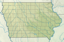
Mason City Municipal Airport (IATA: MCW[2], ICAO: KMCW, FAA LID: MCW) is located six miles west of downtown Mason City, in Cerro Gordo County, Iowa, United States.[1] It is in the northern part of Lake Township, just east of the city of Clear Lake. It is used for general aviation and has airline service subsidized through the Essential Air Service (EAS) program.
The National Plan of Integrated Airport Systems for 2021–2025 categorized it as a non-primary commercial service airport.
- ^ a b FAA Airport Form 5010 for MCW PDF. Federal Aviation Administration. effective April 21, 2022.
- ^ "IATA Airport Code Search (MCW: Mason City)". International Air Transport Association. Retrieved June 6, 2014.

