| Matcham Central Coast, New South Wales | |||||||||||||||
|---|---|---|---|---|---|---|---|---|---|---|---|---|---|---|---|
 | |||||||||||||||
 | |||||||||||||||
| Population | 987 (2016 census)[1] | ||||||||||||||
| • Density | 240.7/km2 (623/sq mi) | ||||||||||||||
| Postcode(s) | 2250 | ||||||||||||||
| Elevation | 32 m (105 ft) | ||||||||||||||
| Area | 4.1 km2 (1.6 sq mi) | ||||||||||||||
| Location |
| ||||||||||||||
| LGA(s) | Central Coast Council | ||||||||||||||
| Parish | Kincumber | ||||||||||||||
| State electorate(s) | Terrigal | ||||||||||||||
| Federal division(s) | Dobell | ||||||||||||||
| |||||||||||||||
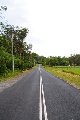
Matcham is a semi-rural suburb of the Central Coast region of New South Wales, Australia. It is part of the Central Coast Council local government area and included in the electoral district of Terrigal.[2] It has a hall and a historic church, St. George's Church, established in 1925.[citation needed]
- ^ Australian Bureau of Statistics (27 June 2017). "Matcham (State Suburb)". 2016 Census QuickStats. Retrieved 19 March 2018.
- ^ "Electoral District of Terrigal". elections.nsw.gov.au. Retrieved 30 January 2019.