| Mather Pass | |
|---|---|
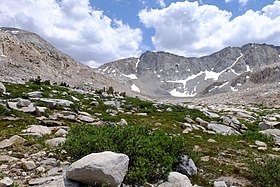
 Mather Pass, the low point in the ridgeline on the left, viewed from the north on the John Muir Trail | |
| Elevation | 12,068 feet (3,678 m) |
| Traversed by | |
| Location |
|
| Range | Sierra Nevada |
| Coordinates | 37°01′55″N 118°27′36″W / 37.0318790°N 118.4601019°W |
| Topo map | USGS Split Mountain |
Mather Pass is a high mountain pass in the U.S. state of California's Sierra Nevada mountain range. It lies within far eastern Fresno County, inside Kings Canyon National Park and the Sequoia-Kings Canyon Wilderness. The pass lies at an elevation of 12,068 feet (3,678 m), separating Palisade Basin (containing the Palisade Lakes and Palisade Creek) to the north and Upper Basin (containing the headwaters of the South Fork Kings River) to the south.[1]
The pass is traversed by the John Muir Trail and the Pacific Crest Trail, which are coincident (sharing the same route) between Crabtree Meadows and Tuolumne Meadows. It is one of the six high mountain passes above 11,000 feet on the John Muir Trail, along with Donohue Pass, Muir Pass, Pinchot Pass, Glen Pass, and Forester Pass; it lies south of Muir Pass and north of Pinchot Pass. Split Mountain, one of California's fourteeners, lies immediately southeast of Mather Pass; the Palisades group of peaks contains another three to the north of the pass.
- ^ "Mather Pass Feature Details". Geographic Names Information System. Archived from the original on July 29, 2022. Retrieved July 29, 2022.
