| May Gabat | |
|---|---|
 The May Gabat River near the confluence with Giba River | |
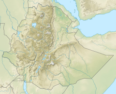
May Gabat River in Tigray Region | |
| Location | |
| Country | Ethiopia |
| Region | Tigray Region |
| Districts (woreda) | Inderta |
| Physical characteristics | |
| Source | Hiza'iti Wedi Cheber |
| • location | Mereb Miti in Inderta |
| • elevation | 2,233 m (7,326 ft) |
| Mouth | Giba River |
• location | Kayeh Guila in Debre Nazret municipality |
• coordinates | 13°28′34″N 39°17′49″E / 13.476°N 39.297°E |
• elevation | 1,590 m (5,220 ft) |
| Length | 42 km (26 mi) |
| Basin size | 652 km2 (252 sq mi) |
| Width | |
| • average | 15 m (49 ft) |
| Discharge | |
| • location | Near confluence with Giba River[1] |
| • maximum | 190 m3/s (6,700 cu ft/s) |
| Basin features | |
| River system | Permanent river |
| Tributaries | |
| • right | Kalamino River |
| Waterbodies | Hiza'iti Wedi Cheber, Gereb Segen, Gereb Bi'ati, Addi Hilo |
| Waterfalls | Maryam Bahrawti |
| Bridges | Mereb Miti; road to Gijet |
| Topography | Mountains and deep gorges |

The May Gabat is a river of northern Ethiopia. Rising in the mountains of Inderta (2,233 metres above sea level), it flows westward to Giba River, which empties finally in the Tekezé River.[2] The Gereb Segen reservoir has been built on this river in 2016, mainly for providing Mekelle with potable water.[3]

- ^ Amanuel Zenebe, and colleagues (2013). "Spatial and temporal variability of river flows in the degraded semi-arid tropical mountains of northern Ethiopia". Zeitschrift für Geomorphologie. 57 (2): 143–169. Bibcode:2013ZGm....57..143Z. doi:10.1127/0372-8854/2012/0080.
- ^ Jacob, M. and colleagues (2019). Geo-trekking map of Dogu'a Tembien (1:50,000). In: Geo-trekking in Ethiopia's Tropical Mountains - The Dogu'a Tembien District. SpringerNature. ISBN 978-3-030-04954-6.
- ^ Mebrahtu, Gebreslassie; Abay, Asmelash; Hailu, Gebrerufael; Hagos, Miruts (2020). "Electrical resistivity imaging and engineering geological investigation of Gereb Segen dam, northern Ethiopia". Bulletin of Engineering Geology and the Environment. 79: 83–95. doi:10.1007/s10064-019-01577-0. S2CID 199098746.
