| Mayenne | |
|---|---|
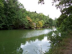
 The Mayenne and Sainte-Apollonie Island near Entrammes | |
 | |
| Native name | La Mayenne (French) |
| Location | |
| Country | France |
| Physical characteristics | |
| Source | |
| • location | Perche |
| • elevation | 300 m (980 ft) |
| Mouth | |
• location | Maine |
• coordinates | 47°29′35″N 0°32′34″W / 47.49306°N 0.54278°W |
| Length | 202.3 km (125.7 mi) |
| Basin size | 5,820 km2 (2,250 sq mi) |
| Discharge | |
| • average | 50 m3/s (1,800 cu ft/s) |
| Basin features | |
| Progression | Maine→ Loire→ Atlantic Ocean |
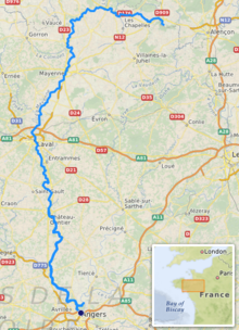
The Mayenne (French pronunciation: [majɛn] ) is a 202.3 km (125.7 mi) long river in western France, principally located in the French region of Pays de la Loire.[1] Together with the river Sarthe and its tributary the Loir it forms the Maine, which is a tributary to the Loire.