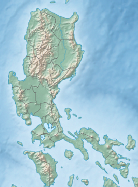
| Mayon | |
|---|---|
| |
 Mayon Volcano in 2020 | |
| Highest point | |
| Elevation | 2,463 m (8,081 ft)[1] |
| Prominence | 2,447 m (8,028 ft)[1] |
| Listing | |
| Coordinates | 13°15′24″N 123°41′06″E / 13.25667°N 123.68500°E |
| Geography | |
 | |
| Country | Philippines |
| Region | Bicol Region |
| Province | Albay |
| Cities and municipalities | |
| Geology | |
| Rock age | > 20,000 years[2] |
| Mountain type | Stratovolcano |
| Volcanic arc/belt | Bicol Volcanic Chain |
| Last eruption | 2024 |
| Climbing | |
| First ascent | Scotsmen Paton & Stewart (1858)[3] |
Mayon (Central Bikol: Bulkan Mayon; Tagalog: Bulkang Mayon, IPA: [mɐ'jɔn]), also known as Mount Mayon and Mayon Volcano (Spanish: Monte Mayón, Volcán Mayón),[4] is an active stratovolcano in the province of Albay in Bicol, Philippines. A popular tourist spot, it is renowned for its "perfect cone" because of its symmetric conical shape, and is regarded as sacred in Philippine mythology.[5]
The volcano with its surrounding landscape was declared a national park on July 20, 1938, the first in the nation. It was reclassified as a natural park and renamed the Mayon Volcano Natural Park in 2000.[6] It is the centerpiece of the Albay Biosphere Reserve, declared by UNESCO in 2016,[7] and is currently being nominated as a World Heritage Site.
Mayon is the most active volcano in the Philippines, and its activity is regularly monitored by the Philippine Institute of Volcanology and Seismology (PHIVOLCS) from their provincial headquarters on Ligñon Hill, about 12 kilometers (7.5 mi) from the summit.[8]
- ^ a b de Ferranti, Jonathan; Aaron Maizlish. "Philippine Mountains – 29 Mountain Summits with Prominence of 1,500 meters or greater". Retrieved January 31, 2011.
- ^ Mirabueno, M. H. T.; Okuno, M.; Nakamura, T.; Newhall, C. G.; Kobayashi, T. (2006). "AMS Radiocarbon Dating of Paleosols Intercalated with Tephra Layers from Mayon Volcano, Southern Luzon, Philippines: A Preliminary Report". Bulletin of the Volcanological Society of Japan. 36 (2). Volcanological Society of Japan: 23–28. ISSN 0386-118X.
... the oldest eruptive event must have taken place shortly before 20 cal kyr BP.
- ^ "Encyclopædia Britannica, Vol. 18, 9th Ed.", pg. 749. Henry G. Allen & Company, New York.
- ^ Salao, Renzo (August 31, 2018). "Mayon Volcano's History Has A Story To Tell". Deal Grocer. Retrieved August 28, 2019.
- ^ "Ancient Bicolano Pantheon of Deities and Creatures – Philippine Mythology". The Aswang Project. February 8, 2016. Retrieved August 28, 2019.
- ^ "Protected Areas in Region 5" Archived December 19, 2013, at the Wayback Machine. Protected Areas and Wildlife Bureau. Retrieved on October 15, 2011.
- ^ "Albay | United Nations Educational, Scientific and Cultural Organization".
- ^ Cite error: The named reference
PHIVOLCSwas invoked but never defined (see the help page).


