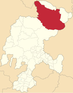
Mazapil | |
|---|---|
 Church in Mazapil | |
 Location in Zacatecas | |
| Coordinates: 24°38′18″N 101°33′19″W / 24.63833°N 101.55528°W[1] | |
| Country | |
| State | |
| Established | 17 January 1825 |
| Seat | Mazapil |
| Government | |
| • President | Gregorio Macías Zúñiga |
| Area | |
| • Total | 12,143.256 km2 (4,688.537 sq mi) |
| Elevation [1] (of seat) | 2,268 m (7,441 ft) |
| Population (2010 Census)[3] | |
| • Total | 17,813 |
| • Estimate (2015 Intercensal Survey)[4] | 17,457 |
| • Density | 1.5/km2 (3.8/sq mi) |
| • Seat | 794 |
| Time zone | UTC-6 (Central) |
| • Summer (DST) | UTC-5 (Central) |
| Postal codes | 98230–98287[5] |
| Area code | 842 |
| Website | Official website |
Mazapil is a municipality in the Mexican state of Zacatecas and the state's largest municipality by area. The Peñasquito mine, Mexico's largest gold mine, is located in this sparsely populated municipality.
- ^ a b "Sistema Nacional de Información Municipal" (in Spanish). SEGOB. 2010. Retrieved 16 January 2018.
- ^ "H. Ayuntamiento Mazapil". Government of Mazapil. Retrieved 16 January 2018.
- ^ a b "Mazapil: Datos generales". Cédulas de información municipal (in Spanish). SEDESOL. 2013. Retrieved 16 January 2018.
- ^ Panorama sociodemográfico de Zacatecas 2015 (PDF). INEGI. 2016. p. 66. ISBN 978-607-739-890-5. Retrieved 16 January 2018.
- ^ "Descarga de Códigos Postales". Catálogo Nacional de Códigos Postales. Mexican Postal Service. 11 January 2018. Retrieved 16 January 2018.
