| Meal Fell | |
|---|---|
 Meal Fell seen from Great Cockup with Great Sca Fell behind. | |
| Highest point | |
| Elevation | 550 m (1,804 ft) |
| Prominence | c. 30 m (100 ft) |
| Parent peak | Knott |
| Listing | Wainwright |
| Coordinates | 54°41′36″N 3°06′56″W / 54.6932°N 3.11545°W |
| Geography | |
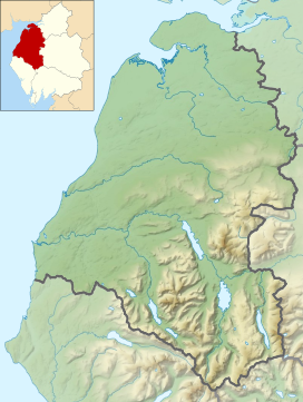
Location in the Lake District National Park | |
| Location | Cumbria, England |
| Parent range | Lake District, Northern Fells |
| OS grid | NY282337 |
| Topo map | OS Landranger 89, 90 OS Explorer 4 |
Meal Fell is a small fell in the northern region of the English Lake District, it is situated seven kilometres (4+1⁄4 miles) south-west of the village of Caldbeck and is one of the four main Uldale Fells (the others being Longlands Fell, Great Cockup and Great Sca Fell).

